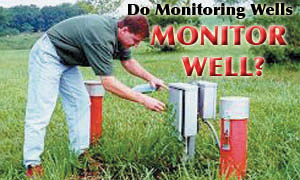
The primary function of ground water monitoring wells is to provide subsurface access for the measurement of liquid levels and the collection of liquid samples for analysis. In the underground storage tank (UST) program, the liquids that we are most concerned with are ground water and petroleum products, whether in the non-aqueous or dissolved phase. Monitoring wells also may be used to collect gas/vapor samples and measure vertical transport properties, and they are convenient (although rarely optimally located) places to install various components of remediation systems.
Given that monitoring wells have such a wide variety of important uses, why is it that so little consideration actually is given to the question of whether the data we derive from them is of adequate quality? This question may come across as being contrary to conventional wisdom, but let's think about it. Let's begin by laying out a scenario for a “conventional” site assessment that relies on typical monitoring wells, and then we'll dig a bit deeper to uncover some shortcomings.
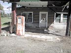
Scenario: We have a typical neighborhood gas station that sits on a square-ish quarter-acre lot at the intersection of two relatively busy streets. The station building is a one-story brick structure - an office/storeroom occupies one-third of the building, and two garage bays occupy the other two-thirds. One of the two pump islands (each with two dispensers) is in front of the station and parallel to the street; the other is parallel to the side street.
There are three large 2,000- to 10,000-gallon USTs used for fuel storage and a small tank for used oil. The entire surface area of the lot is covered with concrete or asphalt. Overhead power and telephone lines run above the property lines parallel to both streets. Underground utilities (i.e., water, sewer, natural gas) also run parallel to the property line marking the front of the property.
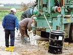
Representatives from an environmental company hired by the owner/operator to conduct a site assessment arrive at the station. They visually survey the station layout, noting the painted markings on the pavement where the utility company has delineated the water, sewer and natural gas lines, and proceed to install a monitoring well as close as possible to each of the four corners of the station property.
However, due to the locations of overhead and underground utilities, the tank field, the pump islands, the waste oil tank and the station building, the locations for the monitoring wells must be shifted somewhat from the originally intended locations at the property corners. As a result, in plan, these four points outline a compressed and elongated quadrilateral, not a square.
At each location, the drill rig advances a 10- to 12-inch diameter bit in 5-foot increments and then stops to allow for undisturbed soil samples to be collected. Each sample is 18 inches to 24 inches in length. A geologist records the lithologic information for each sample and screens each interval with an organic vapor meter/analyzer for the presence of petroleum hydrocarbons.
Beginning with the first detection of organic vapors, soil samples are placed in labeled jars and stored on ice in a cooler. Later, the jar with the sample containing the highest reading from each borehole will be sent to a laboratory for analysis. The on-site geologist also logs cuttings between the undisturbed samples.
When the boring finally reaches the water table, it is advanced another 5 feet to 10 feet, and then the casing and screen are installed. The casing and screen consist of a 4-inch inside diameter Schedule 40 PVC pipe with factory-threaded couplings and factory-cut slots (0.020 inch). Sufficient lengths of casing and screen are installed such that the screened portion extends 5 feet to 10 feet below and above the water table to allow for seasonal variation.
The screened portion is backfilled with coarse (#2) sand to a level that is a foot or two above the top of the screen. On top of the sand is a bentonite seal that is 2 feet to 5 feet in thickness. The remaining annular seal-to-land surface is sealed with a bentonite-grout slurry. The wellhead itself is protected either with a flush-mount cover or steel surface casing. The top of the well is fitted with a locking, watertight well cap.
Later, the newly installed well is “developed” using either pumping or surging techniques. Finally, after being allowed to recover for at least 24 hours past development, the well is ready for water level measurement and liquid sample collection.
Sounds familiar, doesn't it? With respect to the above scenario, conventional wisdom holds that the stratigraphy, water table and ground water flow direction all are well defined. Each boring has a continuous log plus undisturbed samples at 5-foot intervals.
Analysis of soil samples from each boring indicates only minor amounts of residual contamination near the tank field. Analysis of ground water samples from each of the four wells indicates (we'll assume) that they are essentially free of dissolved hydrocarbons. Quarterly gauging of the water levels indicates that water table fluctuations should remain within the screened interval so that none of the wells will go dry. Since the well casings are 4-inch inside diameter, if needed, they can accommodate free-product recovery (and other remediation technology) equipment.
For purposes of the following discussion, we'll assume that there is no problem with sampling or well installation techniques - this isn't a discussion of push technologies vs. conventional drilling rigs, or expedited assessment vs. conventional techniques. Our focus is strictly on the design and location of the monitoring wells. So what can the problem(s) possibly be?
Divining the Water Table
In Euclidean geometry, three non-colinear points in space are required to define a plane (if the points were colinear, then an infinite number of planes - all equally plausible - could be drawn through the line). By assuming that the water table is planar, the magnitude and direction of ground water flow can be determined. The “conventional” site assessment described above employs not just three but four monitoring wells, so the ground water flow direction can be well defined from these data, right? Wrong!While three points in empty space are adequate to define a mathematical plane, the water table isn't in empty space, and it is hardly a plane. Its position relative to a lower confining layer depends upon a number of variables that include amount and location of recharge sources, soil permeability, soil heterogeneity and location and strength of pumping wells and other sinks.
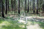
How many wells are sufficient? That's not an easy question to answer, except to say that it's site-specific. In any case, the more wells there are, the more accurately the water table can be defined. If we accept that we're limited to just four locations on any given site, we can learn a lot more if several wells with shorter screens at different elevations are nested at each of these four locations. This is absolutely essential if we're to evaluate the presence and importance of vertical transport at a site.
Ground Water Flow Direction(s)
It is typically assumed that by default, three of the wells are down gradient and one well is up gradient - but up gradient and down gradient from what? Tank field excavations (which are backfilled with pea gravel) have a conductivity that is relatively higher than that of the surrounding soil. Rainwater runoff that flows beneath the paved surface but on top of the soil often collects in tank fields, creating a water table mound that dominates local ground water. Radial flow from the tank field excavation (a primary source of potential ground water contamination) virtually assures that some portion of contamination will migrate in a direction where there are no monitoring wells.By confining the site investigation to the UST property, a very small area is used to infer the magnitude and direction of ground water flow. This practice can lead to some predictive problems, such as water table mounding in the tank pit, effects on flow based on how much of the surrounding area is paved and distribution of recharge-inducing features, such as leaking storm drains or ditches.
Such effects can perturb the regional ground water flow system. While transport of contaminants near the site may depend on these effects, off the property the regional flow may dominate and direct contaminants in a different direction.
Because the array of four wells at our typical site usually is elongated in one direction and compressed in the other, there is a high degree of uncertainty associated with our interpretation of ground water contours. Recognizing the fact that there is a subjective element to all contouring (even that which is based on linear interpolation), strictly speaking, only those contours that lie within the region bounded by our four data points are allowed to be solid lines - all other contours must be dashed to show the uncertainty associated with them.
Postulating Potentiometric Surfaces
Our scenario assumes that the water directly beneath the site exists under unconfined conditions (which often is the case). But, in many geologic settings, layering of soil types of different permeabilities can create localized perched water zones as well as confined zones. Especially in coastal plain sediments, even thin clay layers (which may not be recognized to be continuous over the site due to the wide sample collection intervals) can create such zones.
When well screens of 10 feet to 20 feet are open to these different zones, the water level measured in the well is an amalgam of all of the different potentiometric surfaces of these different zones. Consequently, the measured water level may not have any correlation whatsoever with the presumed direction of ground water flow. In addition to providing erroneous information on flow directions, such wells facilitate cross-contamination of deeper water-bearing zones.
Collecting Ground Water Samples
With the understanding that monitoring wells with relatively long screened intervals (10-20 ft.) cannot be relied upon to provide accurate information about water table elevations, how can they be expected to provide accurate information on ground water quality? They can't.Even if the stratigraphy at a given site were purely homogeneous and isotropic (such that there are no preferential flowpaths) and each of the down-gradient wells actually intersected the plume, ground water samples withdrawn from each well would be a composite of the concentrations over the entire screened interval.
The result always is that measured concentrations are less than the true maximum. How much difference can this make? It is possible that this effect can dilute concentrations to below detection limits. But, even in this ideal case where ground water flow to the well could be assumed to be laminar, ground water flow into the pump (or other collection device) would be influenced by vertical location of the pump intake. In the case where well screens are open to different water-bearing units, it is impossible to generalize what the effect might be.
The most logical way to locate a contaminant plume would be to place sampling points along the length of the plume and to select some locations that are off the main axis of the plume. Unfortunately, the reality of the situation is that the location of the plume in most cases is only known through samples collected from wells. If our conventional site assessment uses wells placed arbitrarily at the property corners, they should not be expected to provide delineation of the centerline or extent of contamination. These can only be determined from a set of wells or other sampling points that transect the plume.
Aquifer Testing
Monitoring wells are essential for providing data on aquifer response to pumping stress. However, as with defining the water table or potentiometric surface, or for collecting representative samples, wells with long screened intervals also may yield erroneous information during aquifer tests. It is critical that the pumping well and the monitoring wells tap the same hydrostratigraphic unit.
With a conventional four-well arrangement, as in our scenario, aquifer test results could provide only a gross estimate of average aquifer permeability and yield. While this may be the objective of water supply investigations, it is essentially useless for determining contaminant travel time. Because contaminants migrate along preferential flow paths that generally have higher than average permeability, the true transport velocity of contaminants may be significantly underestimated. The result is that contaminants may arrive at potential receptors much earlier than predicted.
Installing Remediation Systems
One of the cost-savings objectives in a conventional site assessment as per our scenario is to allow for remediation equipment (especially free product recovery devices) to be installed in any of the wells, as needed. Is this really how a remediation system should be designed? The answer is a resounding “No!”We've already established that the locations of the monitoring wells are essentially random relative to the distribution of contamination. So how is it that we can believe that their locations could possibly result in the installation of an effective (let alone optimal) remediation system?
Further, given how ineffective many of these systems are, how long most of them are operated, and how much they cost to operate and maintain over the years, how much cost savings actually is realized by a decision to arbitrarily limit the number of wells installed at a given site?
Ne'er Do Well
The preceding paragraphs are intended to illustrate some of the things that monitoring wells should not be relied upon to do. So, what can we conclude about conventional monitoring wells with long screened intervals?
- Four wells generally are insufficient to provide necessary information about subsurface conditions at any given site.
- Nested wells with short screened intervals should be installed in favor of wells with long screened intervals.
- Measured water table elevations may not correlate to the same hydrostratigraphic unit from well to well.
- Concentrations of contaminants in ground water samples may be significantly lower than the true concentration at that point.
- Results of aquifer testing (i.e., permeability, transport velocity) should be assumed to be best case (least conservative) because averaging gives a lower conductivity than the maximum.
- The effectiveness of remediation systems should not rely on the random location of monitoring wells.
All's Well That Ends Well
This article turned out to be lengthier than I originally intended, and still it doesn't address all the monitoring well issues that I'd hoped it would. Perhaps it is naïve to expect that long-entrenched behavior would be favorably altered based on a single article, no matter how convincing the argument. (That is, however, my hope, if not my expectation.) Part II of this article will summarize monitoring well design guidance.ND


Report Abusive Comment