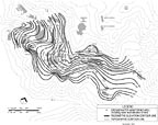
Rarely does the piezometric surface reflect this phenomena for a number of reasons. The water level surface often has a very small slope toward the pumping well which may not be evident if the contour interval is not fine enough, i.e. measured to 0.1 foot or less. The more transmissive the aquifer, the smaller the slope will be at a given pumping rate, i.e. a lake (high transmissivity) will have a very small, probably immeasurable, sloping toward the spill way or culvert if present. On the other hand, a tight clay aquifer will have a steep slope in order to induce movement of ground water toward the pumping well. The steep slope is needed to overcome the friction and capillary forces impeding the horizontal flow.
Pumping water levels inside of well casings almost always are lower than the true water level immediately outside of the pumping well. Ideally, if a well were 100 percent efficient and the horizontal movement was slow enough not to create friction losses, then the water level in the well would be representative of the aquifer in that area. This rarely is the case.
If the pumping water level is plotted with the surrounding water levels, the contours usually will show a very steep gradient at the well, which is not representative of true water levels only a few feet away from the pumping well. If the desire is to show the water level near the pumping well, it would be advisable to install a separate well of similar construction a few feet away to obtain true aquifer water levels.


Report Abusive Comment