Characterizing and managing the quality of both surface and ground water are issues that are of great importance throughout the United States. Factors that affect the quality may be local or regional, natural or man-made, chemical, hydrological or all of the above. The Onondaga Lake and Tully Valley region of New York, near Syracuse, is no exception. Surface and ground water quality is either known or believed to be affected by a number of natural and human-related factors.
The Onondaga Lake Cleanup Corporation (OLCC), headed by Dr. Ed Michalenko, was created in 1990 to address remedial measures to clean Onondaga Lake. In 2000, the Onondaga Lake Partnership (OLP) was created to facilitate and coordinate development and implementation of projects for the environmental restoration, conservation and management of Onondaga Lake. This partnership includes members of the OLCC, the U.S. Geological Survey (USGS), the Assistant Secretary of the Army for Civil Works, the U.S. Environmental Protection Agency (EPA) and the State of New York.
Long-term water-quality management requires an understanding of the natural conditions that provide the physical framework for the water, or hydrologic, system. In the Onondaga Lake and Tully Valley area, understanding the physical framework requires having an understanding of the stratigraphy of unconsolidated sediments that contain salt - present as either a solid form or in dissolved in ground water to form brine - and the hydrologic conditions that affect the movement of these brines through the subsurface and into surface water.
To develop this understanding of the physical framework, the OLCC, USGS and EPA initiated a subsurface investigation project that would require completion of deep borings and continuous sampling through unconsolidated sediments and into bedrock, water sampling of discrete intervals and installation of monitoring wells. The OLCC-USGS-EPA team made the decision to use an innovative subsurface exploration method, called sonic technology, to meet the objectives of this project.

A Little Background
Salt in the lake is nothing new, since as long ago as the mid-17th century, salt or brine springs were noted as being around the southern end of Onondaga Lake, which then was called Salt Lake. Since the late 1700s, salt was collected or produced from this brine - first from springs and later from shallow wells installed to collect the brine. As the concentration of brine from the springs and shallow wells in the Salt Reservation diminished, Solvay Process Co. drilled several deep test holes. Halite deposits, or rock salt, were found at depths of more than 1,200 feet at the south end of the Tully Valley. More than 120 brine wells ultimately were advanced in this valley.From 1797 until 1917, when the operation ended, the Onondaga Salt Reservation produced more than 11.5 million tons of salt. Between 1890 and 1986, the brine wells in the Tully Valley produced 96.2 million tons of salt. In its final 25 years of operation, Solvay Process Co. (which later became Allied Chemical) pumped 1 billion gallons of brine each year from the Tully Valley brine field to its plant. Soon after the plant shut down in 1986 and salt mining in the region ended, concern developed about how the end of the brine pumping and salt extraction would affect surface and ground water movement and quality.
As noted by the USGS: “The northward movement of brine to the southern shore of Onondaga Lake results from artesian pressure, driven by elevational differences between the southern Tully Valley and Onondaga Lake. The unconsolidated glacial materials above the bedrock in the Onondaga Creek valley provide the hydraulic connection between the halite deposits and the springs.” Additionally, the Salina Group Shales, a bedrock formation, contain halite or rock salt beds that are thicker in the southern part of the Tully Valley and exposed to ground water in the base of the bedrock valley.
The salt problem remains complex as new salt sources are identified. Recently, Bill Kappel of the USGS, an authority on Onondaga Lake geology and hydrogeology, discovered a large spring pumping salt into Onondaga Creek. Early studies found the spring pumping salt at the rate of 10 pounds per second, or seven tons of salt tons each day. This spring and others may have resurfaced as the salt resources, over-extracted in the past, replenished.
In addition, as Onondaga Creek flows northward through the Tully Valley to Onondaga Lake other hydrogeologic features such as mudboils - holes in the earth that discharge mud and soft sediments from underground - also act to decrease the water quality. In the central part of Tully Valley, mudboils discharge artesian fresh water, brackish water and fine-grained sediment onto the land surface and into Onondaga Creek. These mudboils reflect regional subsurface hydrogeologic conditions. Previous investigations have shown that flow from a mudboil is driven by artesian pressure that forces water and sediment upward from two sand and gravel aquifers through a 60-foot layer of dense silt and clay. The artesian pressure can lift water 20 feet to 30 feet above land surface within most of the valley floor and 30 feet above land surface near Onondaga Creek.
The Study
To address the concerns related to the movement and the quality of ground water and surface water, the previously mentioned study was initiated. The purpose of this project was to obtain additional geologic and hydrologic data to supplement prior regional hydrogeological studies of the Onondaga Creek Valley and its tributary valleys. The study would involve drilling some of the deepest wells ever for brine in Onondaga County to obtain an understanding of vertical and horizontal ground water movement and water quality in deep, unconsolidated deposits and adjacent upper bedrock units of the Onondaga Valley of Central New York. The OLCC and USGS wanted continuous or near-continuous sampling through the unconsolidated deposits (estimated to be 400 feet thick), bedrock coring and the installation of monitoring wells/piezometers to determine water levels and water quality. Highly artesian and over-pressurized aquifer conditions were anticipated, along with the presence of concentrated brines in some intervals.
Sonic Technology Selected
With its sonic technology, Bowser-Morner Inc., Dayton, Ohio, was selected to provide subsurface exploration services for this project. Sonic technology, introduced into the United States in 1985 after extensive use in Canada, primarily is used for environmental subsurface applications, including soil sampling and the installation of monitoring and remediation wells. The advantages of sonic technology include continuous core sampling, depth capability, speed, lack of cuttings, telescoping diameter flexibility, monitor well nesting and associated cost savings.
Sonic technology relies on vibrations to get the work done in this unique way. Two counter-rotating rollers inside chambers in the sonic head generate centrifugal force. The oscillator in the head converts the centrifugal force to a sinusoidal or longitudinal force, producing frequencies of up to 180 hertz or 10,800 cycles per minute of vibrational energy. An air spring in the sonic head isolates the vibrations from the rest of the rig and directs the energy down the drill string to the bit with little or no dampening. The high-frequency resonant vibrations fluidize the soil particles at the bit face - a process called liquefaction - and allow the core barrel to penetrate rapidly through most geological formations, including over-consolidated tills, boulders and weathered bedrock. In addition, solid bedrock can be cored with traditional equipment using the vibrational energy to enhance penetration rates. As the core barrel is advanced, it collects a four-inch-diameter (or larger) continuous core sample of the material penetrated.
Technical Approach
The technical approach for this unique project was designed with these project objectives in mind: continuous soil and bedrock core sampling for development of subsurface stratigraphy and identification of intervals of hydrologic importance, and water sampling to develop a “stratigraphy” of water quality. Additionally, it was necessary to address the possibility of large volumes of brine water being encountered in known areas of hydraulic over-pressuring. First, a drilling mud system was designed to be used with the sonic technology to combat brine and artesian conditions. Sonic technology was used to advance each boring with a 4-inch-diameter continuous core over-drilled with 6-inch casing to an estimated 50 feet to 80 feet. Once the first confining zone was reached, a 12-inch-diameter, permanent, steel conductor casing was cemented into place. This casing also improved safety control of the borehole. The boring then was advanced from the bottom of the 12-inch casing to the bedrock with a 4-inch-diameter, continuous sonic core using 6-inch, 8-inch and 10-inch temporary casings as needed to stabilize the borehole. Bedrock, estimated to be at depths ranging from 400 feet to 500 feet, was sampled with 4-inch core samplers and 6-inch-diameter casings. From each boring where bedrock was encountered, a 15-foot-long rock core was obtained. After analyzing all the samples, nested wells were installed in each borehole and developed. Wellhead protection also was installed, and the site was cleaned and restored.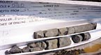
Project Details
The subsurface sampling and well installation began in June of 2003. In addition to the typical sonic setup of rig and support vehicles, this project required a drilling mud system that consisted of a 70-barrel steel pit with desilters and a pump system. Drilling mud was recirculated continuously through the desilters to control solids in the mud. The mud mix used was salt gel and water-loss control materials mixed with fresh water. Salt-water gel was used to drill through salt-water aquifers. The mud design was mixed to maintain a viscosity that would carry the small sand and silts but not the larger cuttings and gravel out of the well bore. Using the sonic technology allowed the large drill cuttings and gravel to become the annulus of the well bore.At the first location, casing was advanced through, and continuous samples collected of unconsolidated sediments to bedrock at a depth of 368 feet. Twelve feet of bedrock core were collected, making the final depth of the borehole 380 feet. Problems with heaving sands during well installation necessitated abandonment of this first borehole and completion of a new borehole nearby. A well was installed in this borehole at a depth of 313 feet.
At the second location, casing was advanced to a depth of 427 feet. Strong artesian conditions, including heaving sands, were encountered at this depth. Artesian flow at the wellhead was estimated to be 100 gallons per minute. Flow also was observed outside of the casing, indicating artesian annular flow. This borehole was abandoned by grouting.
At another location, casing was advanced to 409 feet before the Vernon Shale group was encountered. The hole then was cored to 418 feet; and a well was installed to 415 feet with a sump from depths of 385 feet to 415 feet, and screen and sand pack from depths of 385 feet to 365 feet. The well then was sealed and grouted.
At the fourth location, casing was advanced to a depth of 162 feet before encountering bedrock. Two wells were installed in this borehole, with screens at depths of 110 feet and 160 feet.
Throughout the project, nearly complete and continuous soil samples were recovered from each borehole. It was noted, however, that at times, the combination of the sonic and the rotary action contorted or twisted and compacted or stretched the core, a situation that complicated some stratigraphic horizon picks. In general, these disturbances were restricted and did not significantly impact meeting the primary objectives of the project. At two of the locations, core samples of bedrock also were collected using sonic technology.
Conclusions
As previously stated, the primary objectives of this subsurface project were to define the subsurface stratigraphy of the unconsolidated glacial deposits in the Onondaga Valley near Onondaga Lake, define intervals of hydrologic importance (over-pressurized and artesian zones) and collect water samples to define vertical variations in water chemistry associated with brine concentrations. How did the use of sonic drilling technology help meet these objectives? According to Kappel, “We needed the unconsolidated core to determine and understand the glacial processes that created the unconsolidated fill in the valley, and to determine the presence of brackish to brine water that we knew was within these glacial sediments. The nearly continuous recovery of core allowed us to 'see' the general stratigraphy of the sediments and determine the concentration of saline to brine water in the stratigraphic column.”As Kappel added, “The recovery of nearly continuous core has given us a much clearer picture of the glacial history of the Onondaga Valley and the presence of brine in these sediments. The collection of water quality data has also given us some insights as to the possible origin of the brines.” Sonic technology was successfully applied to help the client meet the objectives of a project in a geologic setting with challenging subsurface conditions. ND

Report Abusive Comment