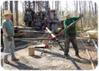
The reason that this area is of special interest is that it lies slightly southeast of a zone of anomalously rapid eastward drop-off of the geologic layers of the Coastal Plain. One category of rapid drop-offs, called monoclines, occurs because the layers near the surface are draping downward over one or more deeply buried faults. The presence of faults in this area would significantly complicate the geologic and hydrologic interpretation of the subsurface geology, so it is necessary to determine if faults are present in order to accurately interpret the geology of this area. Drilling on both sides of this monocline-like feature will allow us to determine whether any faults are present and, if so, the amount and timing of movements on the fault(s) over the last 110 million years.
Report Abusive Comment