


My first memories of the drilling industry were spending my Saturdays riding along with my father to job estimates and project site assessments. It was the mid-1980s and we would spend the day visiting jobs, ensuring the material was delivered and that the equipment could easily maneuver from the public road onto private land. Before we started our adventure, we would plan our navigation at breakfast with a county plat book. We would meet the customer at the site, and he and my father would evaluate the area where the well would be drilled and discuss any issues.
I continued the same boots-on-the-ground evaluation process in my 20s as the driller responsible for successful job completions. Twenty years later, it’s inconceivable to believe that we were able to get anything done without smartphones, GPS and the internet. Today, 21st-century site evaluation starts with an online map search followed up with an interactive satellite view. The tools given to us by modern technology have become invaluable and a perfect starting point, but these technologies have still not progressed beyond physically walking the next project.
The 5,000-Foot View
Ironically, for information and technology to progress, they require continuous improvement to their infrastructure. Many of these improvements come from drilling projects in rural or far remote locations. Often, these rural projects start as points on a topographical map from a web-based satellite. Looking at a project from a bird’s eye view has many benefits.
Aerial views allow me to find the project’s access from public roads. Depending on the time of year and region, it is possible that the shortest route to arrive on site may not be available due to weather or a change in seasons. In late winter to middle spring, local road weight restrictions, called frost laws, can affect site access and require special permitting. After the frost is gone, the flooding starts and that can drastically change a job commute. My GPS has taken me to many flooded-out roads in the Midwest and Southeast.
Next, top-down views allow me to look for clues to drilling challenges. I first look for rock outcrops and changes in elevation that could give me an idea about shifts in geology. On a drilling project in northern Ohio that followed Lake Erie, the aerial view allowed me to see two large rock quarries followed by a large river with a floodplain. That information spurred me to request mats for site access across the floodplain, and to plan for possible loss circulation zones near the two quarries. I also look for potential points of contamination such as slurry ponds, drain fields and other environmental concerns. Finally, aerial views help with the pre-planning, helping to determine if a site has enough space for all required equipment and for drilling processes.
To use satellite views effectively, it is essential to understand that most imaging programs come from an archive. Although the images give the feel of a real-time view, they are not. Only “Big Brother” gets live satellite viewing capabilities, and that technology is not utilized for drilling. Since satellite image databases are dated, they quickly become misleading to project managers and engineers involved in the planning. These images do not show the impact of each season, from rainfall to overgrowth. Aerial views can also mislead project planners when it comes to where possible human-made obstructions are located. Finally, these views do not show a good representation of a site’s terrain. Rocky, wet and uneven terrain are not easily seen from a top-down view.
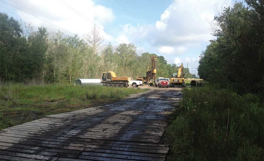
Boots on the Ground
The best way to do a site assessment is in person. I utilize a job-specific checklist that allows me to thoroughly evaluate a site and fully prepare my team for success. My list starts as I drive to the jobsite, considering the project timeline and customer’s expectations. Next, as my truck leaves the large commercial roads, I begin to imagine how the rig would drive the same path. I make note of low-clearance areas and utilities.
When my vehicle reaches the entrance to the site, I get out and walk the path of the rig to the drill site. Again, I am taking this time to observe all potential points of danger and obstruction overhead and on the surface. I look for ground hazards such as washouts, rocky terrain, busted-off fence posts and unmarked utilities. I once worked a job where all vehicles had been entering the site over a large buried gas line. No one on site had taken the time to evaluate the large indent created by the water truck entering and exiting multiple times a day over the line. When the pipeline company came out for a site check, they shut the job down until mats were brought in for travel over the pipeline.
Next, I imagine the rig maneuvering over the hole with thoughts of a spotter signaling the driver to pull over or drive backward over the borehole marker. I stand at the borehole and observe all directions, taking time to find all marked utilities and overhead obstructions.
Once I know that the rig and the potential borehole are in an obstruction-free area, I walk the outer perimeter of the site. I look for more hazards and consider whether the jobsite will require mats, where equipment will be staged, and good places for tooling and material to be laid out. My perimeter walks have uncovered many exciting points of interest. These have included monitoring wells, abandoned cisterns, gravestones, buried junk and even a den of rattlesnakes. On finding that last one, I screamed louder than my 2.5-year-old daughter, Brielle, and ran the quarter mile back to my truck and locked the doors.
It is invaluable to prepare your drill team for success by taking the time to walk a jobsite. To review, my checklist starts with these items:
- Travel to the job.
- Evaluate site access and off-road travel.
- Review the site footprint and layout.
- Consider all known and unknown obstructions.
- Recognize other job-critical impacts.
That last item is a catch-all for things that may affect the job, but aren’t necessarily part of a traditional jobsite review. What might that include? I’m glad you asked.
Other Job Critical Impacts
Beyond site assessment, but just as critical, is taking time to consider off-site factors that can influence the job or the crews. For example, what is the driving distance from the office or hotel to the jobsite? Take time to evaluate whether commute hazards are a possibility. These might include terrain en route to the jobsite, weather conditions for commute times and animals in the road.
I have worked many projects where my commute started before dawn and ended well after sunset. In Republic, Wash., at the Buckhorn mine, I had to travel up and down a mountain and then travel over an hour back to my hotel. Deer and other wildlife were on the road both ways, and over the two years of working there, I knew of at least 20 collisions with animals. When I worked near Tonopah, Nev., I had to be aware of cattle on the roads. They loved to bed down on the warm pavement at night, and my colleague once hit a sleeping cow.
The distance to civilization is also vital to knowing how quickly emergency responders can render aid or, even more critical, mobilize back to a hospital. It is always best practice to locate the closest hospital and prepare for triage.
The most critical and often overlooked impact to job success is the availability and distance to water. Almost all drilling projects require water, and several processes require large amounts. Understanding water availability and the time needed to obtain and return with water can directly impact project success. A water plan and good drilling program are always great solutions when water availability becomes an issue.
Imagining the Worst Thing That Can Happen
Every project I complete gives me a new set of lessons learned. I use these lessons in a mental game I call, “What is the worst thing that can happen?” I play this game on my drive home from a site assessment. I start by thinking of past issues and then move on to possible new ones. I create open plans from prior project experience that will help with preventable measures and fast executable solutions. One situation that I always think about is the likelihood of causing a fire that could get out of control on a project. Depending on job location and time of year, equipment on site can easily cause fires. Wildfires are a grave issue. The devastation recently caused in the U.S. is heartbreaking, and many of these fires were preventable with proper planning. Early in my career, I learned about a geologist who set a several-thousand-acre fire with pickup truck exhaust. Luckily, it was contained and no one was hurt.
An excellent site assessment utilizes technology, a real boots-on-the-ground check and a great imagination. Technology allows us to get a better idea of what could be onsite. The physical check eliminates many known and unknown issues. Finally, taking the time to play out success and failure mentally creates a successful picture efficiently executed. A project-specific checklist that considers all aspects of a job from the start of the day to the end is the best way to be as thorough as possible. Job success starts before the drill and team mobilizes, and finishes with the team returning safely.


Report Abusive Comment